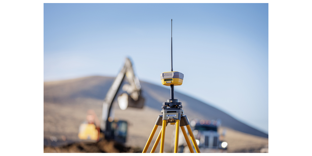
LIVERMORE, CA, Feb 7, 2025 – Topcon Positioning Systems has announced the launch of the HiPer XR, its latest GNSS (Global Navigation Satellite System) receiver for surveying, mapping, and construction applications. The new receiver is designed to benefit users, including construction professionals, surveyors, GIS professionals, archeologists, engineering firms, and others who rely on quality, precision measurements. The HiPer XR builds on Topcon’s 30-year legacy in GNSS technology and supports all major satellite constellations, including GPS, GLONASS, Galileo, BeiDou, IRNSS, QZSS, and SBAS.
The new receiver has advanced TILT (Topcon Integrated Leveling Technology) compensation featuring a calibration-free and magnetic interference-immune integrated IMU that provides up to 60 degrees of tilt for precision measurements in challenging positions. The signal integrity protection, anti-jamming and anti-spoofing capabilities keep data safe, even in areas with interference or tampered signals. For surveyors, construction site foremen, or anyone managing critical operations, this means lesser downtime and better performance, even in challenging environments.
“It’s a powerful receiver in a compact and lightweight body, which makes it incredibly versatile, allowing for multiple configurations. It can be used as a base or rover or through an RTK correction service, such as Topnet Live. Its rugged, water-resistant construction ensures durability in harsh conditions, and with its anti-jamming and anti-spoofing capabilities, users can count on highly reliable GNSS operations,” said Vince Banas, senior vice president of global engineering for Topcon.
“The HiPer XR represents our commitment to developing solutions that address real-world challenges. By combining our proven precise positioning technology with advanced GNSS resilience and a solid foundation of durability, quality, and reliability, we are helping professionals maintain productivity in the most challenging environments.”
About Topcon Positioning Systems

Topcon Positioning Systems, established in 1994 and headquartered in Livermore, California, specializes in precision measurement and workflow solutions for the construction, geospatial, and agriculture sectors. Their product lineup includes GPS receivers, robotic total stations, laser scanners, and mobile mapping solutions, all designed to enhance productivity and accuracy in field operations. As a subsidiary of Topcon Corporation, a company with roots dating back to 1932, Topcon Positioning Systems benefits from a long-standing legacy in optical and positioning technologies. With a global presence, Topcon Positioning Systems continues to innovate, providing essential tools for professionals dedicated to building and feeding the world. As of November 2024, Topcon Positioning Systems employs approximately 1,000 individuals across six continents, including North America, Europe, and Asia. The company operates through a global network of 93 subsidiaries and affiliates.
Source: Topcon