

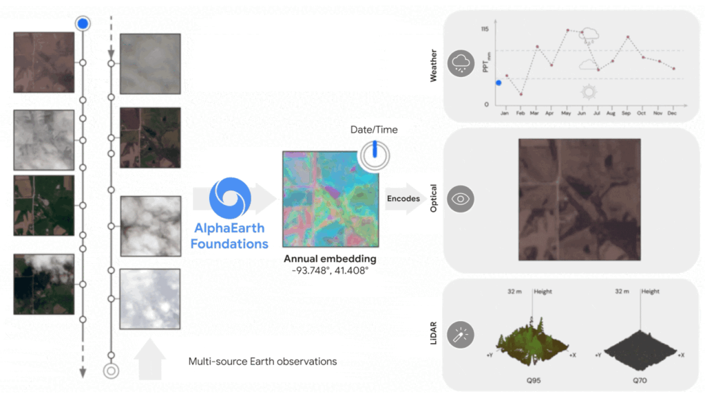
Google DeepMind has introduced AlphaEarth Foundations, an AI model that functions as a “virtual satellite,” offering dynamic, high-resolution views of Earth’s environment without requiring physical orbital hardware. The system processes massive volumes of satellite data—using advanced embeddings to compress terabytes of imagery into condensed, color-coded maps that reveal material properties, vegetation cover, groundwater reserves, and built infrastructure, reports Wired.com.
By integrating diverse observations from decades of Earth imaging, AlphaEarth creates continuous temporal views of specific locations, enabling detailed tracking of how ecosystems change over time. The model’s enhanced accuracy—about 23.9% higher than comparable systems—and its ability to produce reliable data at 10-meter resolution empower researchers with unprecedented environmental clarity.
AlphaEarth is already being used to monitor remote and cloud-obscured regions like Antarctica and to detect subtle land-use shifts in Canadian farmlands—areas where satellite coverage is often limited or obscured. It delivers these insights through Google Earth Engine, making annual “embedding snapshots” available for climate monitoring, land-use planning, and environmental assessment—even for those with minimal coding experience.
Climate researchers and conservationists, including Brazil’s MapBiomas, have benefited from AlphaEarth’s ability to compress and structure vast datasets, significantly improving the speed and precision of rainforest analysis and ecosystem mapping.
AlphaEarth revolutionizes climate monitoring by turning chaotic, expansive satellite data into precise, scalable insights—helping decision-makers identify changes and intervene effectively across ecosystems and landscapes.
