
STOCKHOLM, Sweden, June 15, 2026 – Hexagon has acquired ITRES Research Limited (ITRES) to its airborne mapping portfolio, expanding its offering with hyperspectral and thermal imaging sensors for multi-sensor geospatial data collection and analysis.
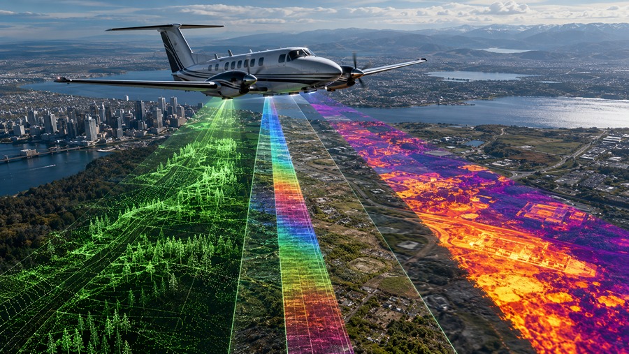
The acquisition brings ITRES’ hyperspectral and thermal imaging systems into Hexagon’s airborne sensing and processing portfolio, which includes LiDAR point clouds, optical imagery, digital twins, workflow software, flight planning tools and data delivery systems. ITRES’ sensors operate across a range of wavelengths, supporting material identification and temperature analysis beyond visible and near-infrared imaging.
The portfolio helps customers collect datasets from a single airborne survey. Integrating multispectral and thermal data with LiDAR and optical imagery opens new possibilities for ground surface assessment, object classification and thermal property detection. Hexagon’s software ecosystem provides tools for processing and using the resulting multi-sensor data.
“Geospatial professionals are looking to extract deeper insight from each airborne survey”, said Anders Svensson, president and CEO of Hexagon. “By integrating hyperspectral and thermal sensing into our portfolio, we further expand the range of information that can be captured and analyzed. Combining complementary sensing technologies helps geospatial professionals improve classification accuracy, better distinguish materials, and derive more reliable thermal insights, supporting more advanced and specialized applications”.
The added hyperspectral and thermal imaging capabilities support environmental applications, including urban heat mapping, water quality monitoring, wetlands analysis, minerals and geology surveys, and forestry mapping. They also apply to disaster response use cases, including locating active fire hotspots, identifying people or objects through heat detection, and providing responders with georeferenced thermal imagery.
“We welcome the ITRES team and its exceptional capabilities within airborne hyperspectral and thermal imaging to the Infrastructure & Geospatial Business Area. From a technology perspective, the portfolios of Hexagon and ITRES are highly complementary, enabling us to meet our customers’ full range of needs in advanced airborne mapping”, said Henning Sandfort, president of the infrastructure & geospatial business area.
ITRES will report within Hexagon’s infrastructure and geospatial business area, under the scanning and mapping division. The company is expected to generate revenue of around 13 MEUR in 2026.
Source: Hexagon
About Hexagon

Hexagon AB is a Swedish industrial technology company based in Stockholm, Sweden. The company traces its origins to Eken Industri och Handel AB, founded in Stockholm in 1975. Hexagon supplies measurement, positioning, sensing, and software products for industrial and public-sector users. Its products include sensors, coordinate measuring machines, laser scanners, positioning systems, CAD/CAM software, geospatial tools, asset lifecycle systems, and autonomous technologies. The company serves customers in manufacturing, construction, aerospace, agriculture, mining, public safety, infrastructure, and mobility. Engineers, surveyors, manufacturers, asset owners, governments, and industrial operators use its products. Hexagon reported about 24,500 employees in 50 countries.
About ITRES Research Limited

ITRES Research Limited develops airborne hyperspectral, thermal and ultraviolet imaging systems for remote sensing. Founded in 1979, the company is based in Calgary, Canada. It designs sensors for crewed aircraft, unmanned aircraft and developing space-based applications. Its products include hyperspectral imagers, thermal mapping systems, and optical sensors. ITRES also provides sensor calibration, software development, airborne surveys, research and system prototyping. Its customers include organizations in environmental monitoring, forestry, agriculture, water quality, geology, mining, oil and gas, wildfire mapping, search and rescue, defense and infrastructure analysis.
