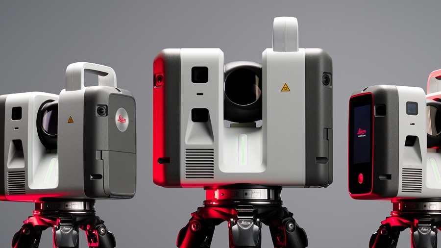
HEERBRUGG, Switzerland, June 19, 2026 – Leica Geosystems has added three terrestrial laser scanners to its RTC lineup: the RTC300, RTC500 and RTC700. The series increases scanning speed, accuracy and range, while adding workflow connectivity between field and office teams from the initial scan through final output.
Scalable Superior Performance
The RTC series combines capabilities from the Leica RTC360 with the accuracy of the ScanStation P-Series. Leica said the scanners support workflows in surveying, construction, industrial plants, public safety and infrastructure.
The platform includes three performance tiers built on the same system architecture. Users can move to a higher performance tier as project size and requirements increase without replacing their system.
Connected Workflows
The RTC series also adds connected workflow functions for scanning, registration and data sharing, allowing 3D data to move between field, cloud and office while capture is underway. That workflow is supported by Livelink, a new capability in Leica Cyclone FIELD 360 that streams scan data to Hexagon GeoCloud as it is captured. Multiple scanners can feed data into one project, helping teams verify complete site coverage before field crews leave and begin producing deliverables before scanning is finished.
“The RTC series reflects where reality capture is headed: faster data capture, better connected teams, and a platform built to scale,” says Tanja Birner, president at Hexagon’s Scanning & Mapping Division. “It gives customers a more powerful way to work today – and the confidence that their investment scales with them.”
Source: Hexagon
About Leica Geosystems
Leica Geosystems develops measurement, positioning and reality-capture technologies for professional users. The Heerbrugg, Switzerland-based company supplies surveying instruments, GNSS systems, laser scanners, machine control systems, mapping tools and related software. It also provides technical support, training, maintenance and data services. Leica Geosystems serves construction, surveying, engineering, mining, utilities, transportation, public safety, manufacturing and government customers. The company traces its roots to Wild Heerbrugg, founded in Switzerland in 1921. It later became Leica Geosystems and now operates as part of Hexagon. The company supports customers in about 120 countries. Its tools help users measure, map, model and monitor physical environments. Leica Geosystems also supplies systems for reality capture, digital construction and asset management. Leica has more than 3,800 employees worldwide.