

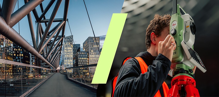
HEERBRUGG, Switzerland, Oct 6, 2025 – Leica Geosystems has introduced the Leica TS20 robotic total station, developed with inputs from surveyors. The system improves field productivity by automating routine measurements, reducing manual errors, and simplifying daily work. Designed around surveying practices, the TS20 helps users complete tasks faster and error-free.
AI-Powered Productivity
The Leica TS20 uses a Neural Processing Unit (NPU) to deliver edge AI capabilities that streamline surveying tasks. The system automates workflow optimization, detects possible errors, and protects data privacy during field operations. AI-powered target search and automatic target recognition (ATR) allow the TS20 to locate and measure targets in rain, mist, or when working with reflective tapes. The AI-Detect feature identifies the target type and alerts users if it differs from the one selected in the software. AI-Follow (available as a software update post-launch), which tracks the Leica AP20 AutoPole even when the line of sight is blocked, help surveyors save time.
Durable, Connected and Protected
The TS20 is a robotic total station with an IP66 rating, providing protection against dust and water. The station is enhanced with user experience through:
- Communication sensors: The TS20 has mobile internet connectivity for data sharing and IoT readiness.
- Maintenance-free motors: Speeds up the instrument, makes it dependable in everyday use and reduces ownership cost.
- A new electronic distance measurement (EDM) system: Delivers distances with higher frequency.
- High-speed processors: Accelerate tasks such as startup times or processing.
The TS20 works with Leica Geosystems’ existing software and cloud ecosystem, accessories, and the AP20 AutoPole.
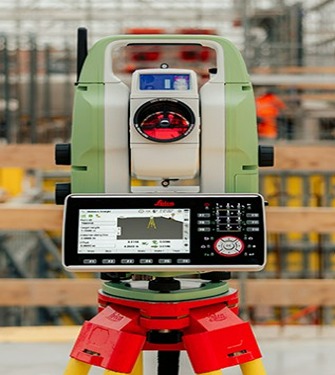
GeoCloud Protect offers safety features like remote locating and locking. TS20 operators can access the station’s location on a map and, in case of theft, mark it stolen and lock the station so it can neither be used nor serviced.
“The Leica TS20 is the most significant leap forward in total station technology in over a decade,” says Moritz Lauwiner, executive vice president at Hexagon’s Geosystems division and president of the geomatics division at Leica Geosystems. “Built from the ground up, the TS20 is the result of a close partnership between our survey engineering experts, the innovation prowess of a world-class R&D team, and the invaluable insights of our customers, whose evolving workflows and expertise guided every aspect of its design. The result is an instrument purpose-built to meet the demands of modern surveyors, empowering them to succeed in every job and condition.”
Source: Leica Geosystems
About Leica Geosystems

Leica Geosystems, based in Heerbrugg, Switzerland, develops precision measurement instruments, software, and services for surveying, construction, infrastructure, manufacturing, aerospace, and defense. Its portfolio includes laser scanners, total stations, GNSS receivers, digital levels, 3D imaging tools, and geospatial software. The company traces its origins to 1819 with the founding of Kern & Co. and has evolved into a global leader in measurement and reality capture technologies. Operating as part of Hexagon AB, Leica Geosystems serves professionals who rely on spatial data for design, construction, and analysis.
