FRANKFURT, Germany, Oct 10, 2025 – Topcon Positioning Systems has expanded its geomatics portfolio with new mass data software solutions that support connected workflow environments. The company will showcase the solutions at INTERGEO 2025 in Frankfurt, Germany, from Oct. 7 to 9, 2025.
Neil Vancans, head of the new Geomatics sales unit, said, “We are entering a new chapter focused on helping professionals work smarter by streamlining workflows, boosting collaboration, and simplifying digital transformation.”
Topcon will launch a new scanning portfolio, accompanied by a software platform. “The new scanning portfolio and software platform will enable us to provide the benefits of AI to the common workplace for a multitude of sensors. The principle is flexibility. By integrating sensors across price points and accuracy levels into a common platform, Topcon aims to provide customers with the right tool for the right job,” Vancans said.
“Customers are looking for streamlined and effective workflows. Topcon is addressing this need by prioritizing workflow simplicity, open integrations, and compatibility with mixed fleets. We are designing an ecosystem that will provide value for the customer.”
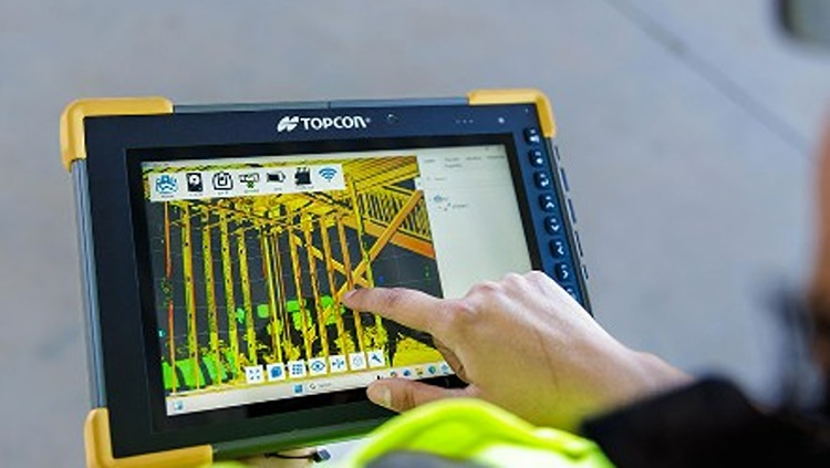
Topcon’s connected workflow is built on its Collage and ClearEdge software platforms, which handle data processing, feature extraction, and integration with GIS, BIM, and CAD systems. Topcon Collage, offered in Site, Office, and Web versions, serves as a central data hub that improves data sharing between field and office teams. Topcon is also introducing the Collage Cloud Connector to strengthen integration with Autodesk applications and ClearEdge solutions such as EdgeWise or Verity.
Featured hardware and software include:
- CR-H1 handheld scanner: The CR-H1 handheld mapping system uses iPhone Pro devices with LiDAR to capture georeferenced images and generate full-color 3D point clouds through photogrammetry. The iPhone connects to the Topcon HiPer CR receiver, providing centimeter-level accuracy using RTK corrections from the Topnet Live GNSS corrections service. Mounted on a single handle, the receiver and iPhone let users capture point clouds one-handed while walking the job site.
- CR-M1 scanner and new Onami software: The CR-M1 is an indoor/outdoor mapping system that can be mounted on a backpack or survey pole. It supports mapping in urban areas, construction sites, multi-story buildings, underground spaces, mines, real estate, stockpiles, and forests. Data published through Collage Web enables browser-based visualization and editing of 3D point clouds and meshes.
- CR-P1 multi-functional 3D terrestrial laser scanner: The CR-P1 generates real-time, georeferenced point clouds on-site, giving users access to actionable data for various applications. Updates to the Topcon Collage Site software solution add new mass data workflows that improve real-time data capture and processing precision, throughput, and performance.
- CR-S2 handheld scanner with Magnet Flow and Bridge software: The CR-S2 is a handheld scanning system that uses fusion-SLAM localization for mapping in complex environments. It supports construction, infrastructure, and open-area applications such as beaches, coastlines, farmland, and airports. In open environments, an RTK connection to the Topnet live network ensures position quality. Data published to Collage Web enables browser-based 3D point cloud and mesh visualization with built-in measurement and annotation tools.
- LN-1000i Layout Navigator with Topcon Digital Layout software: The LN-1000i expands the Layout Navigator series with reflectorless measurement, a green laser pointer, and a camera for live view and prism tracking. When used with Topcon Digital Layout 2.0 software, the instrument improves efficiency in building construction layout tasks.
- Expanded Hybrid Positioning capabilities with Topcon software updates for Field – Office – Tools – Enterprise: The system improves coordination between GT robotic total stations and the HiPer XR GNSS receiver, creating an optical and GNSS hybrid solution. The new software version 10 uses IMU tilt data to enhance prism measurements in hybrid positioning mode.
- Collage Cloud Connector: New Windows app designed to simplify and automate the process of downloading and synchronizing project data from Collage Web to a local machine for use with Autodesk, ClearEdge3D software, or Collage Office.
Source: Topcon
About Topcon Positioning Systems
![]()
Topcon Positioning Systems, founded in 1994 and based in Livermore, CA, provides precision measurement and workflow solutions for construction, geospatial, and agriculture sectors. Its products include GPS receivers, robotic total stations, laser scanners, and mobile mapping solutions focused on productivity and accuracy in field operations. As a subsidiary of Topcon Corp., the company draws on long-standing legacy in optical and positioning technologies. As of November 2024, Topcon Positioning Systems employs about 1,000 people and operates on six continents through a network of 93 subsidiaries and affiliates.