Bentley Systems acquired Cesium last month and made a big deal of it at their Year in Infrastructure event, which recently concluded in Vancouver.
Cesium, a leader in the visualization of 3D geospatial data, is an open platform. The company specializes in creating high-precision, time-dynamic 3D geospatial data used in various sectors such as defense, infrastructure, and urban planning. With this acquisition, Bentley aims to integrate Cesium’s graphic streaming technology into its iTwin platform, enhancing digital twin capabilities for infrastructure projects worldwide.
Bentley promises to let Cesium be open-platform, used by other vendors, even if they are Bentley’s competition.
Cesium’s expertise will allow for the visualization and analysis of large-scale 3D geospatial data in real time, improving decision-making processes for engineers and developers. The acquisition also reinforces Bentley’s commitment to open standards and interoperability, ensuring that Cesium’s technology remains accessible to a broad range of industries and users. By combining forces, both companies aim to push the boundaries of infrastructure engineering and digital twin applications globally.
How much Bentley paid for Cesium was not disclosed.

Cesium CEO Patrick Cozzi justifies selling the open-source platform to Bentley by emphasizing the alignment of values and the long-standing relationship between the two companies. Cozzi highlights that both Bentley and Cesium share a commitment to open standards, open-source technologies and APIs, which are fundamental to Cesium’s mission. He points out that Bentley’s support for their efforts in open standards and open sources, including their contributions to 3D Tiles and CesiumJS, reflects their dedication to interoperability and openness, making the acquisition a natural extension of their collaboration.
Cozzi also notes that by joining Bentley, Cesium can accelerate its vision and expand its platform’s reach in the built and natural environments. He stresses that Bentley’s resources will enable Cesium to deliver on long-requested features and capabilities faster than it could have as an independent company, thus benefiting the broader developer ecosystem that relies on Cesium.
About Cesium.
Cesium got its name from the chemical element cesium (also spelled “caesium”), which is known for its use in atomic clocks and GPS technology. The element cesium is significant for its precision in timekeeping and geolocation, which resonates with Cesium’s mission of providing accurate, high-performance 3D geospatial data. The name reflects the company’s focus on high-precision, time-dynamic, and massive-scale geospatial applications, similar to the role cesium plays in providing time synchronization for global positioning systems. This connection to precision and geospatial accuracy likely inspired the company’s founders when selecting the name.
How Does Cesium Work?
Cesium manages massive graphical datasets using a technology called 3D Tiles, which breaks down large-scale geospatial data into smaller, manageable pieces, or “tiles.” This tiling process allows the system to display data at different levels of detail depending on how close the viewer is to the object.

Picture from video by Pennoni.
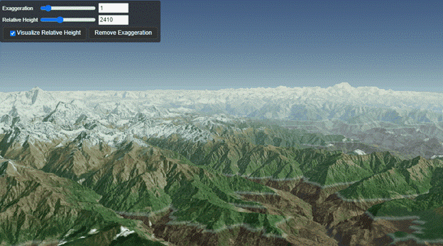
When you are viewing a scene from a distance, like looking at a mountain range, Cesium shows only the larger, coarser tiles that represent the overall shape and structure. As you zoom in, more detailed tiles are loaded dynamically, displaying finer details, down to the granularity of grains of sand if necessary. This hierarchical structure, somewhat similar to fractals, allows Cesium to efficiently handle datasets that span vast areas while maintaining high performance and detail at any scale.
The tile-based approach ensures that only the necessary amount of data is processed and visualized at any given time, reducing memory and computational load while delivering seamless zooming and panning across large datasets
