LOS ANGELES, CA, Feb 24, 2025 – Leica Geosystems announced a new partnership with the Southern California Institute of Architecture (SCI-Arc), created to help train the next generation of architects. The partnership will enable students and faculty at SCI-Arc to experiment with advanced, user-friendly laser-scanning hardware and software, offering hands-on experience with intuitive reality capture solutions that will shape the future of architecture, landscape architecture, urban planning and design, media-based art, and more.
“Architects are increasingly leveraging new technologies to create immersive projects, which means that students need to have access to innovative solutions to stay ahead of the curve,” said Fabio Ponzio, executive vice president at Leica Geosystems. “SCI-Arc has earned a reputation for preparing students for any eventuality, and we are honored to work alongside such inventive thinkers. Together, we can drive transformative progress in the media, entertainment and related design fields.”
As part of the new partnership, Leica Geosystems is supplying SCI-Arc with over $200K of technology donations, including LiDAR scanners like the Leica BLK360— a laser scanner that captures photorealistic 3D scans of areas, structures and objects — and the Leica BLK2GO — a handheld mobile scanner that can capture structures and complete layouts anywhere. Leica Geosystems will grant a substantial amount of scholarship funding for postgraduate students in the EDGE program that aims to advance the frontiers of architecture.
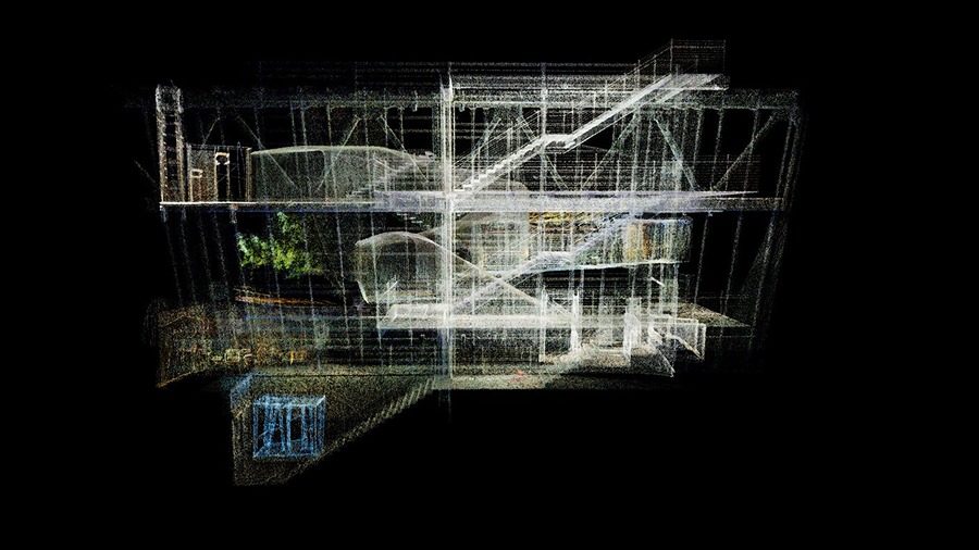
Leica Geosystems laser scanning experts will share their knowledge with students. The experts will guide students in using these advanced solutions in their design workflows. Students are experimenting with Leica Geosystems scanners to capture point cloud scans at the SCI-Arc campus and the SCI-Arc AltaSea incubator in San Pedro. Students can use LiDAR scans instead of photogrammetry to create customized software for automating building design. They can then produce 2D site plans and construct 3D models from text.
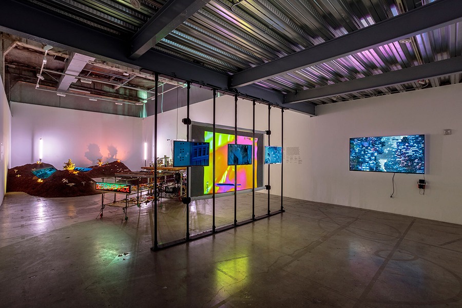
Students and researchers at SCI-Arc are using Leica Geosystems technology in creative projects as well, beginning with the research and art exhibition, Views of Planet City.
Views of Planet City: Urban Foraging
Developed within the Getty Foundation’s cultural initiative “PST ART: Art and Science Collide,” Planet City examines what the world could look like if half the Earth were reserved for nature and the 10 billion remaining humans retreated into a single megalopolis. To help design that incredible city, artist, and SCI-Arc faculty, John Cooper pioneered a new architectural look using “foraging” techniques to show what a city built around need might look like using existing structures and materials.
Cooper’s project within the exhibit, titled Planet City Spoils, offered a new aesthetic created from structures around Los Angeles. Cooper’s team deployed a BLK2GO scanner at chosen locations to capture a building’s structural makeup and materials. Each LiDAR scan was then added to a “shadow archive,” where artists could disassemble and reassemble scans to build digital and physical models using their chosen tools (including Cloud Compare, Rhino, Blender, and Unreal Engine).

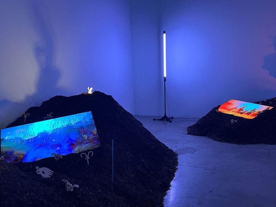
Views of Planet City: Scanning the Wilderness
Planet City presents an exclusive vision of a possible urban future while also showing what untouched parts of the world may look like. In the related multimedia project, Feral Planet, SCI-Arc faculty, and artist Angelica Lorenzi aimed to capture LiDAR scans of some of the most remote areas on Earth. The scans formed the basis for a series of short films that illustrate the process of restoring uninhabited wilderness.
Lorenzi and her team went to uncommon locations and deployed BLK360 to capture vegetation, geographic elements, and the topography of each site. From there, the scans were uploaded and edited within Unreal Engine to create textured 3D assets, including animated models.
“The postgraduate programs at SCI-Arc EDGE broaden what an architect is capable of doing in the world by developing new knowledge and expertise,” said SCI-Arc postgraduate programs chair David Ruy. “Despite competing predictions about the future, direct experience with emerging technologies has always been the best crystal ball. I am thrilled to engage in this partnership and can’t emphasize enough how significant this relationship will be for our students and faculty.”
Source: Leica Geosystems
About Leica Geosystems

Leica Geosystems, headquartered in Heerbrugg, Switzerland, has transformed measurement and surveying for nearly 200 years. As part of Hexagon AB, the company offers a comprehensive range of products and services, including 3D laser scanners, airborne sensors, construction lasers, and software solutions. The tools are utilized across various industries, such as aerospace, defense, construction, manufacturing, and media production. Leica Geosystems employs over 3,500 professionals worldwide.
About Southern California Institute of Architecture (SCI-Arc)

The Southern California Institute of Architecture (SCI-Arc), established in 1972, is an independent architecture school in downtown Los Angeles. It offers undergraduate, graduate, and postgraduate programs dedicated to educating architects poised to transform the future. Serving the architecture and design industries, SCI-Arc emphasizes experimental and avant-garde approaches to architectural education. The approximate annual revenue of SCI-Arc is $82.2 million.