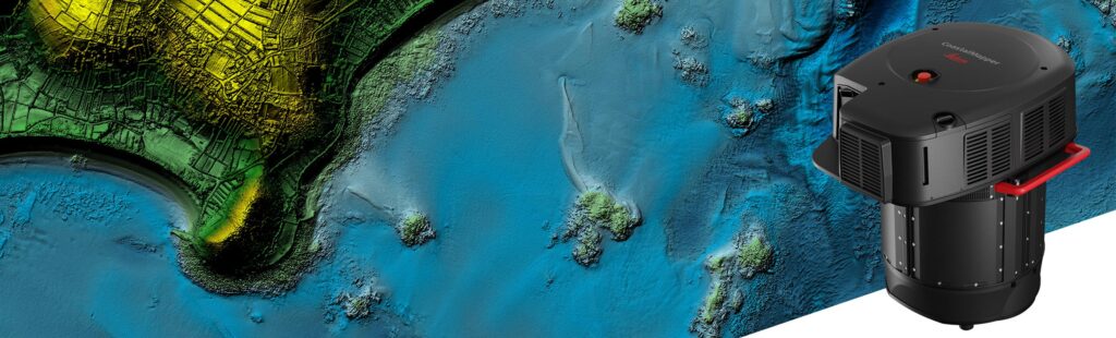
HEERBRUGG, Switzerland, Feb 11, 2025 – Leica Geosystems, part of Hexagon, has announced the launch of the Leica CoastalMapper. The new airborne bathymetric LiDAR solution increases survey efficiency of coastlines and rivers by 250% compared to previous sensor generations.
The Leica CoastalMapper brings a new generation of airborne hydrographic mapping solutions to the industry and offers unmatched performance across a wide variety of mapping applications, from infrastructure resilience to river flood monitoring and environmental investigations in shallow and deep waters.
“We aim to empower our community with tools that meet current needs, anticipate future challenges and push the boundaries of bathymetric mapping,” says Anders Ekelund, vice president of airborne bathymetric LiDAR at Leica Geosystems. “We’re beyond pleased to offer our customers this radically enhanced system for more detailed and efficient surveys. Powering easier yet more comprehensive data analysis and supporting a broad range of bathymetric applications, the CoastalMapper opens mapping possibilities that were hard to achieve before.”
Redefining Bathymetric Efficiency
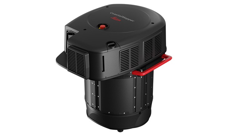
The CoastMapper combines a high-performance bathymetric LiDAR module with a Leica TerrainMapper-3 topographic LiDAR and imaging sensor into a compact, lightweight sensor head. The system captures up to one million data points per second with the bathymetric channel and up to two million points per second with the topographic channel, while providing imagery at a 5-centimetre ground sampling distance (GSD) at common flying heights.
Simultaneous collection of bathymetric and topographic LiDAR and imaging enables broad data capture in a single flight, significantly reducing the survey time, operational costs and environmental impact of each mission. Uniquely, the system can be mounted to a helicopter, enabling surveying in complex environments, such as rivers with steep mountainous terrain.
Maximum Productivity for Flexible Applications
The CoastalMapper integrates with Leica Geosystems established and trusted airborne mapping workflows, minimizing training time and simplifying operations for existing customers. Thanks to cluster processing capability, users can analyze large data sets, reducing the time from data collection to deliverable, such as classified point clouds, digital terrain, surface models and imaging products.
About Leica Geosystems
Leica Geosystems, headquartered in Heerbrugg, Switzerland, has transformed measurement and surveying for nearly 200 years. As part of Hexagon AB, the company offers a comprehensive range of products and services, including 3D laser scanners, airborne sensors, construction lasers, and software solutions. The tools are utilized across various industries such as aerospace, defense, construction, manufacturing, and media production. Leica Geosystems employs over 3,500 professionals worldwide.
Source: Leica Geosystems AG