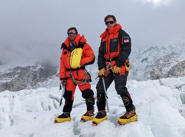
Mechanical engineering professor Eric Gilbertson and his twin brother Matthew are quietly reshaping the world’s understanding of mountain heights, one summit at a time. Their work began after Eric, who had climbed what he believed were Colorado’s 100 highest peaks, noticed anomalies in U.S. Geological Survey data for Crestone Peak. Satellite models suggested another nearby point, later named East Crestone, might actually be taller. Rather than rely on existing records, Eric returned to the mountain with advanced surveying tools to find out, tells The New York Times article.
That approach defines the Gilbertsons’ broader mission. When they climb mountains, they carry Differential Global Navigation Satellite System equipment capable of inch-level accuracy, far beyond consumer GPS. By collecting hours of data directly from summits, they compare candidate peaks that fall within satellite margins of error and determine which point truly rises highest. Using this method, Eric confirmed East Crestone is one-third of a foot taller than the traditionally accepted summit, a finding published in a peer-reviewed journal.
What began as a Colorado curiosity has grown into an ambitious global project called Country Highpoints. The twins aim to climb and precisely measure the highest mountain in every nation. Along the way, they have uncovered errors in long-accepted records, including in Saudi Arabia, where they showed Jabal Ferwa to be about 10 feet taller than the officially listed high point. Similar efforts have established new highest peaks in countries such as Gambia, Uzbekistan, Togo, and Guinea-Bissau.
Their work also reveals how landscapes change over time. Melting ice caps have altered summit heights, as seen on Mount Rainier, where a rocky rim now stands higher than the ice-covered Columbia Crest. Despite the rigor of their data, formal recognition depends on mapping authorities and naming boards, processes that can take years. Still, the Gilbertsons continue climbing, measuring, and publishing, driven by a simple goal: replacing assumption with verified truth and showing that even the world’s mountains are not as fixed as maps suggest.