Zoom In from Mountains to See Grains of Sand

With Cesium, you can keep zooming in to see a stunning amount of detail, to pebbles if not grains of sand. Image: Cesium.

Bentley Systems acquired Cesium last month and made a big deal of it at their Year in Infrastructure event, which recently concluded in Vancouver.

Cesium, a leader in the visualization of 3D geospatial data, is an open platform. The company specializes in creating high-precision, time-dynamic 3D geospatial data used in various sectors such as defense, infrastructure, and urban planning. With this acquisition, Bentley aims to integrate Cesium’s graphic streaming technology into its iTwin platform, enhancing digital twin capabilities for infrastructure projects worldwide.

Bentley promises to let Cesium be open-platform, used by other vendors, even if they are Bentley’s competition.

Cesium’s expertise will allow for the visualization and analysis of large-scale 3D geospatial data in real time, improving decision-making processes for engineers and developers. The acquisition also reinforces Bentley’s commitment to open standards and interoperability, ensuring that Cesium’s technology remains accessible to a broad range of industries and users. By combining forces, both companies aim to push the boundaries of infrastructure engineering and digital twin applications globally.

How much Bentley paid for Cesium was not disclosed.

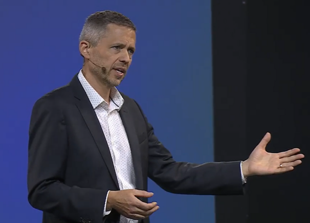
Bentley’s CTO Julien Motte greets Cesium CEO Patrick Cozzi on the main stage at Bentley Systems Year in Infrastructure 2024.

Cesium CEO Patrick Cozzi justifies selling the open-source platform to Bentley by emphasizing the alignment of values and the long-standing relationship between the two companies. Cozzi highlights that both Bentley and Cesium share a commitment to open standards, open-source technologies and APIs, which are fundamental to Cesium’s mission. He points out that Bentley’s support for their efforts in open standards and open sources, including their contributions to 3D Tiles and CesiumJS, reflects their dedication to interoperability and openness, making the acquisition a natural extension of their collaboration.

Cozzi also notes that by joining Bentley, Cesium can accelerate its vision and expand its platform’s reach in the built and natural environments. He stresses that Bentley’s resources will enable Cesium to deliver on long-requested features and capabilities faster than it could have as an independent company, thus benefiting the broader developer ecosystem that relies on Cesium.

About Cesium.

Cesium got its name from the chemical element cesium (also spelled “caesium”), which is known for its use in atomic clocks and GPS technology. The element cesium is significant for its precision in timekeeping and geolocation, which resonates with Cesium’s mission of providing accurate, high-performance 3D geospatial data. The name reflects the company’s focus on high-precision, time-dynamic, and massive-scale geospatial applications, similar to the role cesium plays in providing time synchronization for global positioning systems. This connection to precision and geospatial accuracy likely inspired the company’s founders when selecting the name.

How Does Cesium Work?

Cesium manages massive graphical datasets using a technology called 3D Tiles, which breaks down large-scale geospatial data into smaller, manageable pieces, or “tiles.” This tiling process allows the system to display data at different levels of detail depending on how close the viewer is to the object.

Multidisciplinary firm Pennoni created a video using Cesium and Google’s 3D Tiles to visualize the dolphins (round concrete structures) that guard the Delaware Bridge against errant big ships, such as the MV Dali that plowed into the Francis Scott Key Bridge on March 6, 2024.
Picture from video by Pennoni.

When you are viewing a scene from a distance, like looking at a mountain range, Cesium shows only the larger, coarser tiles that represent the overall shape and structure. As you zoom in, more detailed tiles are loaded dynamically, displaying finer details, down to the granularity of grains of sand if necessary. This hierarchical structure, somewhat similar to fractals, allows Cesium to efficiently handle datasets that span vast areas while maintaining high performance and detail at any scale.

The tile-based approach ensures that only the necessary amount of data is processed and visualized at any given time, reducing memory and computational load while delivering seamless zooming and panning across large datasets

Fuzor is Groundbreaking. Literally.

Amongst all the booths on the show floor at Bentley Systems Year in Infrastructure, one was getting a lot of attention. Happy customers were dropping by the Fuzor exhibit to shake hands and give thanks. This was no startup looking to get noticed. This was a company that had already arrived. I had some catching up to do.

It turns out Fuzor is a comprehensive virtual design and construction (VDC) software purpose-built for animating every bit of the construction before it takes place.

Use it on the job or before to get the job.

“We found that firms are using Fuzor to win contracts,” says Pat Argiles, VDC Accounts Manager at Fuzor, “who proceeded to open my eyes with what all that Fuzor can do, showing exactly how the dig, grading, construction, complete with earth moving equipment and cranes, is going to happen. Getting the job after seeing this careful preparation would be a slam dunk for any construction firm. Then, after they get the job, construction firms can commence with the work, all sequencing neatly orchestrated, with little left to chance.

With Fuzor, contractors can see animations of equipment moving in and moving about, dirt being dug, and cranes hoisting steel… all of it in 3D. There could be no better big-picture guide on how to get from brownfield to high rise – or whatever building or structure is going up.

We see 3D earthmovers and cranes in operation. They, and much more equipment, have been modeled and are available in a library.

Fuzor has a suite of advanced features for architects, engineers, and project managers. At its core, Fuzor provides 4D simulation (the 4th dimension, time, so animation)  so construction firms can create construction sequences over time by integrating building information models (BIM) with scheduling data. This dynamic simulation allows stakeholders to foresee how projects will progress day by day, enabling them to plan logistics, manage resources, and prevent delays.

Fuzor enters yet another dimension: 5D, which adds cost data to the model. You can use it to track the financial impact of scheduling decisions in real-time.

You can check out a project in virtual reality (VR). Fusor’s integration creates an immersive environment where team members can explore the project as if it were already built, aiding in design reviews and stakeholder presentations. This realistic experience enhances communication, ensuring everyone has a clear understanding of the project.

Fuzor is not just about building; it can be used for civil infrastructure projects, with animations of roads, bridges, and tunnels, incorporating material properties and environmental conditions. Urban planners can get into it, too, for land use, transportation systems, and city planning scenarios, facilitating sustainable development.

What Makes Fuzor Different?

Fuzor distinguishes itself from other VDC software in several key ways:

  • Real-Time Rendering and Immersive Visualization: Fuzor provides real-time rendering, allowing users to make changes to models and instantly see their impact. This includes integration with virtual reality (VR), giving stakeholders a highly immersive experience where they can walk through and interact with models.
  • 4D and 5D Simulations: Unlike some VDC tools that focus primarily on 3D models, Fuzor incorporates both time (4D) and cost (5D) simulations. This feature allows users to visualize not just the building’s design but also the construction process over time and its financial implications.
  • Advanced Collaboration Tools: Fuzor enables multiple stakeholders to work simultaneously on a project in real time. This collaborative approach ensures that architects, engineers, contractors, and clients stay aligned throughout the project lifecycle, improving communication and reducing errors.
  • Microtask Planning and AI Automation: Fuzor’s microtask planning enables detailed site activity simulations, while its AI-driven automation simplifies linking 3D models to schedules. These features reduce manual workload and improve accuracy by ensuring that schedules and designs remain in sync in real-time.
  • Civil Engineering and Urban Planning: In addition to its architectural capabilities, Fuzor is widely used in civil engineering and urban planning. It allows users to simulate the structural behavior of complex infrastructure like roads and bridges, making it versatile for both building and infrastructure projects.

The Fuzor Story

Fuzor was developed by Kalloc Studios, a company founded by Henry Yu in 2006. Initially, Kalloc focused on game development, working with major game companies like Electronic Arts and THQ. Yu may have tired of Grand Theft Auto, inventing more ways of killing people, and wished to do something more constructive. Yu and his team transitioned to the architecture, engineering, and construction (AEC) industry, leveraging their gaming expertise to create high-performance visualization tools.

Fuzor was officially launched in 2014, emerging from Kalloc’s Instant Preview Engine technology, initially designed for game designers. Fuzor’s core mission is to integrate real-time rendering and 4D/5D simulations with BIM tools, enhancing project planning, design, and collaboration in construction. It allows users to visualize complex designs, simulate construction sequences, and track costs over time, all within a virtual reality (VR) environment.

Kalloc Studios’ headquarters are located in Carlsbad, California (famous for another construction company, though it is with little plastic bricks), with additional offices in Hong Kong.

Find out more about Fuzor here.

Design and Manufacturing According to Autodesk

Stephen Hooper is conducting a masterclass in presenting at AU2024. I’ve come to expect that from him over the years. His elocution is absolute and his timing is perfect. He manages to synchronize with the video that is playing! I don’t know how he does it. His accent doesn’t hurt. He’s British.

He is making Fusion quite compelling, but it is oratory and stage presence that steals the show. I wonder if he studied acting. He certainly plays his part well in his division’s (Design and Manufacturing)  flagship product, Fusion.

I want to buy Fusion after listening to Hooper as if, instead of AU, this was the Shopping Channel selling Ginsu knives.

Shots Fired

For the AU2024 drinking game, “AI” took an early lead, but “data” has overtaken it.

Fusion is getting all the love from Autodesk, a gifted child with multiple talents, compared to Inventor, the stodgy spinster who lives at home. All of Autodesk’s attention is going elsewhere, towards Fusion. And Autodesk keeps heaping features on it. Like AI Assistants.

Fusion already does dimensions and makes views automatically. In just a few months, it will be able to preserve symmetry, even in big assemblies. For example, if the track assembly on one side of a gigantic earthmover is changed, the other side changes automatically.

Hooper gives an example of how FlexSim, Autodesk’s factory design application, could have helped with the placement of a new CNC machine in Autodesk’s Birmingham manufacturing location not just getting in the door but also maximizing workflow.

Leading Off

First on stage for Autodesk’s manufacturing division, Srinath Jonnalagadda, VP of Industry Strategy for Design and Manufacturing; what is foremost on his mind? You guessed it. Data.

Data, in this situation, is what is left when you break down big files into their constituent parts. Turning files into data is a high priority at Autodesk. That shouldn’t worry the users of file-based programs whatsoever, we are told. Every AutoCAD, Revit and Inventor will be able to operate as they always have. But behind the scenes, files will have been atomized into databases.

Apparently, storing information as data instead of files allows collaboration via the cloud and interoperability. It is ironic that Autodesk, once keeping DWG files under lock and key, firing resellers if they sold competitive software (notably SolidWorks), is now lauding interoperability and brotherliness sharing files.

“It doesn’t matter what tools a company uses, ours or someone else’s,” says Jonnalagadda.

Jonnalagadda calls to the stage Andrew Warren, senior manager at Bridgestone, Dr. Carlonda Reilly, VP and CTO of Kennametal, and Voho Sea, senior designer at Kia.

From Voho, we hear how AI should be treated like a new employee who has to be trained.

“You can’t expect AI to get it right away.”

Kia is probably using Autodesk’s Form Explorer, the rechristened BlankAI, which creates car exteriors by the thousands.

The discussion turns towards the skills gap, either a result of an aging workforce, manufacturing going overseas, a shortage of youngsters entering, or all of the above. AI is seen as a force multiplier at Kennametal.

Since ChatGPT is remarkably good at generating code, having digested the entire contents of GitHub, generating machine code is mere child’s play.

Autodesk claims natural language prompts in plain English (like write the code to rough out this box”) save 95% of a CNC programmer’s time. Unlike every other boast made by CAD, CAM, and CAE vendors about time savings, this one sounds reasonable.

Warren was hired many years ago at Bridgestone to install the Autodesk vault. He never left.

Bridgestone manufacturing machines are huge and expensive, and their worth is far in excess of the buildings they are in.

“The building keeps our machines dry,” he says.

Hear that, AEC guys?“ Jonnalagadda says to the audience. No penalty flag is thrown. The AEC keynote was earlier and all the AEC guys have left the building.


San Diego Airport Gets a Facelift. Should It, Though?

San Diego’s new Terminal 1. Image Gensler/Autodesk.

There may be no airport left in the United State like San Diego International. That it is a one-runway airport is not that unusual. But that it is downtown, surrounded by a picket fence of skyscrapers, is extraordinary. Those in the high-rise offices may get a kick out of viewing jets fly in and out at eye level, but I wonder if it is totally a white-knuckle experience for the pilots threading the needle between skyscrapers.

Most major metro airports have moved outside of harm’s way. London’s Heathrow (LHR), San Francisco (SFO), Hong Kong (HKG), Chicago (OHR), but San Diego (SAN)  clings to its time begone airfield surrounded by high rises. US Navy pilots landing on a pitching aircraft carrier deck may be aviation’s biggest challenge, but flying into SAN may be the biggest civil aviation’s biggest challenge. But when was aircraft flying into skyscrapers a problem? Oh, yeah. 9/11. I knock on wood.

But instead of heeding a warning, San Diego is doubling down on what doomsayers would think a bad bet. The terminal is getting a $3.8 billion makeover with a new terminal 1.

Who is doing the design and construction?

AECOM and Gensler are playing significant roles in the major renovation of San Diego International Airport, focusing on enhancing infrastructure, accessibility, and sustainability.

AECOM has been selected by the San Diego County Regional Airport Authority to lead the program management for the airport’s Capital Improvement Plan. This includes overseeing the $3.8 billion New Terminal 1 project and the modernization of Terminal 2 East. Key aspects of their involvement include managing the construction of a new entrance road, integrating bike lanes and pedestrian paths, and reserving space for future public transit connections to the airport. The improvements aim to accommodate increasing travel demand while enhancing passenger experience and operational efficiency.

Gensler, as an architectural firm, contributes its expertise to aviation design. They are focused on creating a more inclusive and efficient airport experience, leveraging their knowledge to design innovative spaces that balance functionality with passenger comfort. Gensler’s work includes implementing sustainability measures and adapting airport design trends like electrification and modular construction to minimize the environmental impact.

What role has Autodesk played?

Autodesk has played a significant role in the renovation of San Diego International Airport, particularly in the transformation of Terminal 1 into a modern facility. The company’s design and construction solutions are central to this effort, with tools like Autodesk Docs being used as the common data environment. This platform allows project managers and teams to collaborate seamlessly, storing and sharing all relevant project data in one place.

AECOM, which leads the program management, is utilizing Autodesk’s suite of digital tools to ensure efficient design and construction workflows. Additionally, architecture firm Gensler employed Autodesk Revit to redesign Terminal 1, including the creation of the “Luminous Wave” façade, which enhances natural lighting and passenger experience. The overall project aims to bring the airport in line with contemporary needs, with features like expanded gates, improved roadways, and sustainable designs being central to the renovation efforts.

Autodesk Adds AI Tools to Fusion and Alias

A Fusion sketch fully and automatically constrained. Image: Autodesk.

Autodesk has announced the integration of new AI-driven tools in Fusion and Alias. In Fusion, the AI is to help create models faster and automatically dimension them to make fully annotated drawings from those models. In Alias, AI is to provide automotive styling variations.

The new AutoConstrain, which ought to take all the angst out of creating a profile, the first step in creating a solid model shape, will on its own apply all the constraints needed, whether they make lines parallel or perpendicular,  suggest a dimension… whatever.

Users can accept or modify the suggested constraints. By inferring constraints, Fusion is one step closer to fully automated design – though there is a long road ahead.

Also announced for Autodesk Fusion was the automation of drawing creation. In theory, users can practically push a button and have all drawing views automatically created, complete with dimensions. The tool recognizes critical views like top, side and front and is supposed to even have the ability to make detail, section and isometric views, we are told. As with manually created views, all automatic views maintain consistency with the 3D model, adjusting the drawings in real-time as the design evolves.

Drawing automatically created with view fully dimensioned. Image: Autodesk.

The Form Explorer (formerly BlankAI) in Autodesk Alias uses AI to create automotive exteriors using surface modeling. This uses technology acquired in BlankAI, which was announced at last year’s AU. In addition, to being able to judge the aesthetic qualities of their design, taking into account curvature and surface continuity, the shape could be useful for CFD simulation, but not much else, as the shape is only skin-deep, a zero-thickness surface model.

The new API in Autodesk Fusion 360 expands the software’s capabilities by allowing developers to create custom applications, plugins, and automations tailored to specific needs. It supports a broader range of integrations, enabling users to connect Fusion 360 with third-party systems, tools, or databases, enhancing interoperability across platforms. This API facilitates automating tasks like part generation, file processing, or simulation, reducing manual effort and increasing efficiency.

The Best Infrastructure Designed with Bentley Software of 2024

Winners of Bentley Systems Year in Infrastructure 2024 were announced in Vancouver at what is the only black-tie gala event in the industry. Here are all 12 categories and winners.

Structural Engineering

And the winner is…Hyundai Engineering of Seoul, South Korea for the New Physical Modeling Method for Plant Steel Structures Using STAAD API.

Hyundai Engineering developed a new physical modeling method for plant steel structures using STAAD API to automate structural design processes. The project aimed to reduce repetitive tasks, enhance design efficiency, and improve constructability by creating an analytical digital twin. The approach led to a 70% reduction in structural analysis time and cut design errors by 50%, saving approximately KRW 330 million.

The software used in this project includes STAAD for structural analysis and design automation, which optimized the design process while considering constructability enhancements.

Bridges and Tunnels

And the winner is…JMT of Fredericksburg, Virginia for the Digital Experience for the I-95 Rappahannock River Crossing Construction Project .

The I-95 Rappahannock River Crossing Project in Virginia aimed to reduce congestion by adding six miles of new lanes and four bridges. JMT’s digital approach helped them manage traffic flow during construction and meet environmental standards. By using advanced modeling and simulations, they identified and resolved issues early, saving time and reducing community impact.

The software used in this project includes Bentley Descartes, Bentley Infrastructure Cloud, iTwin, MicroStation, OpenBridge, OpenRoads, ProjectWise, and LumenRT.

Surveying and Monitoring

And the winner is…Water Supplies Department in Kowloon, Hong Kong for the Digital Twin of the Ex-Sham Shui Po Service Reservoir.

The North East Link Central Package, Victoria’s largest infrastructure project, aims to improve connectivity by removing 15,000 trucks from congested roads in Melbourne. The project required complex geological modeling and the coordination of multiple design consultancies to manage subsurface risks. By utilizing advanced geotechnical data and 3D models, the team optimized design, risk management, and construction planning, saving AUD 16 million.

The software used in the project includes GeoStudio, Leapfrog, OpenRoads, PLAXIS, and ProjectWise.

Rail and Transit

And the winner is…SPL Powerlines UK for the Midland Main Line Electrification.

The Midland Main Line Electrification (MMLE) Project aims to enhance rail capacity with 447 kilometers of overhead electrification, reducing travel times and improving sustainability. SPL Powerlines UK used advanced digital tools to manage the project across multiple sections, coordinating data from 20 design organizations. This approach increased first-time submission success by 26%, cut site walkouts by 94%, and improved safety and cost-efficiency.

The software used in this project includes ProjectWise for collaboration, iTwin for digital twin creation, MicroStation for design, and OpenRail for rail-specific modeling, among others such as AssetWise and LumenRT.

Facilities, Campuses and Cities

And the winner is…China ENFI Engineering Co., Ltd. for Project of Comprehensive Waste Management Facilities in Xiong’an New Area.

The Xiong’an Waste Comprehensive Treatment Facility Project is designed to transform the area into a “waste-free city,” processing 3,060 tons of garbage, kitchen waste, sewage, and medical waste daily in a 220,000-square-meter underground facility topped by a park. China ENFI Engineering Co. faced challenges with ventilation, equipment space, fire protection, and a tight schedule. They turned to Bentley’s digital tools, moving from 2D drawings to 3D modeling, unifying 13 design specialties. This shift boosted efficiency by 130%, reduced errors, eliminated the need for four cranes, and saved CNY 13.7 million. Careful planning also cut 50 days from the construction timeline.

The Xiong’an Waste Comprehensive Treatment Facility Project relied on Bentley software tools such as ProjectWise for project delivery, SYNCHRO for construction management, MicroStation for CAD modeling, and the iTwin Platform to implement a digital twin approach,

Construction

And the winner is…Proicere Ltd.,of Seascale, U.K. for the SPRS Retreatment Plant (SRP) Sellafield.

The Sellafield SPRS Retreatment Plant is part of the UK’s Nuclear Decommissioning Authority initiative, aiming to safely transfer, repackage, and store 140 tons of plutonium for 100 years. The project, managed by Proicere Ltd., faces strict regulatory and safety standards, requiring a highly coordinated digital approach. By utilizing 4D planning, they identified over 160 risks, preventing rework and reducing costs, thus ensuring project sustainability.

The software used in this project includes SYNCHRO for 4D planning and scheduling, and,iTwin for creating a digital twin to streamline workflows and enhance risk management.

Enterprise Engineering

And the winner is…Mott MacDonald and HDR of Toronto, Canada for the Ontario Line – Information Management.

The Ontario Line is a 15.6-kilometer subway project in Toronto, aimed at improving transit and reducing road congestion. The line will add 15 new stations, significantly cutting travel times and lowering emissions by removing 28,000 cars from the roads. Mott MacDonald and HDR, the technical advisors, focused on efficiently managing and sharing data among multiple organizations, enhancing project efficiency.

The software used in this project includes iTwin for digital twin management, ProjectWise for data collaboration, SYNCHRO for 4D planning, and Bentley LumenRT for visualization and modeling.

Roads and Highways

The winner is the Department of Public Works and Highways (DPWH) in Manilla, Philippines for the Digital Twin Implementation for NLEX-SLEX Connector Road Project.

The NLEX-SLEX Connector Road Project in Metro Manila addresses severe traffic congestion by constructing an eight-kilometer elevated road connecting major highways. This project significantly reduces travel time and carbon emissions. Challenges such as dense urban environments and equipment logistics were overcome through advanced digital twin technology, improving project efficiency and reducing errors.

The project utilized Bentley software, including iTwin Capture for field conditions, OpenBridge and OpenRoads for 3D modeling, LumenRT for visualization, and SYNCHRO for 4D construction management, enhancing productivity by 15% and logistics by 40%.

Power and Process

And the winner is…PowerChina Zhongnan Engineering Corporation Limited of Dongying, Shandong, China for the Digital Twin of Shandong Energy Group Bozhong Offshore Wind Farm Site A.

The Bozhong Offshore Wind Farm Site A, developed by PowerChina Zhongnan Engineering, is the first grid-parity offshore wind project in Shandong, China. It will generate 1.698 billion kilowatt-hours of clean energy annually, reducing carbon emissions by 1.26 million tons. The project overcame challenges such as complex site conditions and tight deadlines by leveraging digital twin technology, improving efficiency and reducing costs.

The software used includes Bentley Raceway and Cable Management, MicroStation, OpenBuildings, OpenPlant, OpenRoads, OpenWindPower, PLAXIS, ProjectWise, and ProStructures. These tools enabled better collaboration, 3D modeling, and intelligent workflows.

Subsurface Modeling and Analysis

And the winner is… Spark and WSP of Melbourne, Australia for the North East Link Central Package.

The North East Link Central Package, Victoria’s largest infrastructure project, aims to improve connectivity by removing 15,000 trucks from congested roads in Melbourne. The project required complex geological modeling and the coordination of multiple design consultancies to manage subsurface risks. By utilizing advanced geotechnical data and 3D models, the team optimized design, risk management, and construction planning, saving AUD 16 million.

The software used in the project includes GeoStudio, Leapfrog, OpenRoads, PLAXIS, and ProjectWise, which streamlined data integration, collaboration, and modeling for efficient project delivery.

Power Transmission and Distribution

And the winner is… Southwest Electric Power Design Institute Co., Ltd. of China Power Engineering Consulting Group In Liangshan, China for Full Life Cycle Digital Applications of Butuo ±800kV Converter Station.

The Butuo ±800kV Converter Station is part of China’s energy infrastructure, transmitting power from Baihetan Hydropower Station to eastern regions. This project reduces coal consumption by 27 million tons annually and provides electricity for 75 million people. By utilizing digital workflows, the team minimized land use and lowered costs, shortening both the design and construction periods significantly.

The software used includes Bentley LumenRT, MicroStation, OpenBuildings, OpenSite, OpenUtilities Substation, ProjectWise, and STAAD, which facilitated collaborative design, 3D modeling, and project management across the entire lifecycle.

Water And Wastewater

And the winner is…Basic Sanitation Utility Company of the State of São Paulo for the Integra 4.0  Cultural Transformation Through Digitalization.

SABESP’s Integra 4.0 project aims to revolutionize water management across 375 municipalities in São Paulo, Brazil, through digital transformation. By integrating business intelligence and AI into a single platform, the project significantly improves operational efficiency, reducing water losses by 29%. Within seven months, it saved BRL 3.1 million in maintenance costs and reduced carbon emissions through proactive monitoring and rapid response to system issues.

The software used includes OpenFlows for hydraulic modeling and monitoring, providing an integrated, data-driven approach to optimize water resource management and infrastructure maintenance.


Airbus US Adds Smaller Payload to Bartolomeo for ISS

The view from the International Space Station using the Sen observations system of Hurricane Milton as it is over Florida. Image from Sen video.

Airbus U.S. has enhanced Earth observation capabilities on the ISS through its ArgUS platform on the Bartolomeo module, allowing smaller payloads to be hosted alongside payloads for larger experiments. ArgUS, supported by the ISS National Laboratory, enables multiple research projects to operate simultaneously, with standard slots starting at 3U in size. Notable payloads include Sen’s SpaceTV-1, a 4K camera system offering real-time views of Earth, freely available through the Sen app, and BAE Systems’ advanced equipment for climate and weather monitoring. BAE’s contributions include a radio frequency receiver for atmospheric analysis and an infrared camera for environmental imaging.

Image: Airbus

The platform’s newArgUS Multi-Payload Adapter allows for smaller slots, down to 3U size (300 x 100 x 100 mm3).

NASA astronauts Tracy C. Dyson and Suni Williams work inside the Nanoracks Bishop Airlock on the ISS, installing the ArgUS Mission-1 hardware to test its external operations in space. Image credit: NASA

These technologies aim to provide new insights into climate change, natural disasters, and other environmental phenomena while potentially supporting future lunar missions. The ArgUS platform is designed to democratize access to space, offering faster data transfer, technical support, and reduced costs for research institutions and private organizations. Launched on SpaceX’s 30th Commercial Resupply Services mission, this setup aims to accelerate scientific research by making crucial data available quickly and affordably. Through ArgUS, Airbus seeks to lower the barriers to space research, offering a practical and collaborative environment for technology demonstrations and scientific discovery.

The Sen cameras on the ISS, specifically the SpaceTV-1 system, work by capturing real-time 4K video from the station’s external vantage point. The system includes multiple cameras: some focus on Earth, providing views of the horizon and downward perspectives, while others monitor activities around the ISS, such as the forward-facing Harmony docking port. The captured high-resolution video streams directly to Earth and is made freely accessible through the Sen app, allowing users to view real-time footage of Earth from space, supporting educational, research, and environmental monitoring purposes.

Sen is a space technology startup founded in 2011 by Charles Black and based in Guildford, U.K. The company focuses on streaming real-time videos from space using its network of satellites. Its goal is to provide high-definition video data from Earth’s orbit for anyone and everyone, not just for space agencies and the military. The company has raised about $8.54 million in total funding, with its most recent seed round in 2022 backed by investors like Mercia Asset Management and Hemisphere Ventures.

Sen is currently being tested on the International Space Station (ISS), occupying a single slot on the in Bartolomeo,

What is Bartolomeo?

Bartolomeo, developed by Airbus U.S., is a versatile payload hosting platform attached to the International Space Station’s Columbus module. It offers easy, cost-effective access to low-Earth orbit for research and commercial projects. Bartolomeo accommodates a range of payload sizes and provides end-to-end services, including launch, installation, data transfer, and optional payload return. It is ideal for Earth observation, material science, robotics, and more, offering an unobstructed view of both Earth and space. This setup enables institutions and private organizations to carry out space missions without needing complex space systems.

The Bartolomeo system, developed by Airbus, got its name from the historical figure Bartolomeo Dias, a Portuguese explorer. Dias is known for being the first European to navigate around the southern tip of Africa, opening the way for a sea route from Europe to Asia in 1488.

“Airbus is improving our ability to observe and understand our planet as well as democratizing access to space by accommodating more research and technology demonstrations on the ISS than ever before,” said Debra Facktor, head of U.S. Space Systems for Airbus U.S. “Our ArgUS platform on Bartolomeo will accommodate smaller payloads with the same power, data regulation, and monitoring as larger projects.”

“ArgUS is essentially a cosmic co-working space, where diverse experiments perform side by side,” Facktor added.

What is ArgUS?

The ArgUS platform is an advanced payload hosting system on the ISS, integrated into the Airbus Bartolomeo module. It enables smaller research and technology experiments to share space in low Earth orbit, starting at sizes of 3U (300 x 100 x 100 mm³). ArgUS provides power, data management, and environmental monitoring for these smaller payloads. This setup supports a range of applications like Earth observation and space-based technology testing, offering faster data downlink and making access to space more affordable and practical for various research institutions and private organizations.

In Greek mythology, Argus, often called Argus Panoptes, is known as a giant with many eyes. He served as a watchman for the goddess Hera. His numerous eyes made him a perfect guardian, as some of his eyes could rest while others remained awake. Argus is most famous for guarding Io, a nymph transformed into a cow by Zeus. Hermes was eventually sent to put Argus to sleep and kill him, after which Hera placed Argus’s eyes on the peacock’s tail as a tribute.

Bentley’s OpenSite Gets an AI Plus

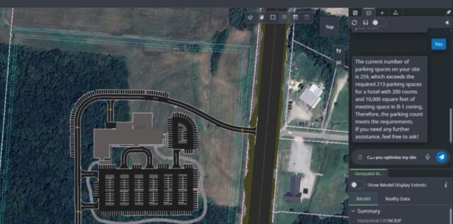
Bentley’s OpenSite+ software with copilot uses organization-specific documents and design models for quick insights and edits. Image: Bentley Systems.

Bentley Systems introduced OpenSite+, a generative AI-based software that aims to significantly streamline certain civil site design processes, at the Year in Infrastructure 2024 conference recently held in Vancouver, Canada.

OpenSite+ is an AI upgrade of OpenSite Designer and part of Bentley’s suite of engineering civil engineering software for site planning. It aims to reduce time and effort in creating, analyzing, and optimizing site layouts. It integrates data-driven automation and machine learning, enabling civil engineers to consider more designs and reduce manual effort.

OpenSite+ is presented as a game-changer for civil engineers involved in land development for residential, commercial, and industrial projects. By utilizing generative AI, OpenSite+ can automatically generate various design alternatives in 3D, allowing engineers to choose the best-solutions based on a variety of criteria like topography, regulatory compliance, and construction feasibility.

What Does OpenSite+ Do?

  • Automated Drawing Production: Users can reduce time spent on mundane drawing tasks, accelerating drawing production by up to 10 times, says Bentley. Drawing will include AI-powered annotation, labeling, and sheeting. Bentley promises annotations will be in the right place, corresponding to a company’s standards and aesthetics. This an answer to all automatic dimensioning that have come before which would systematically litter drawings with dimensions with little or no regard to simplicity and elegance.
  • Enhanced Design Experience with Copilot: Users can quickly create, revise, and interact with site plans and 3D site models through a natural language interfaces—including voice. With iPad increasingly used on sites and requiring two handed operation, voice input makes even more sense on a jobsite than it does in the office.
  • Optimization. OpenSite+ can generate thousands of site plans and rank them for you with one touch of a button. Ranking can be done by the amount of cut and fill each design requires, which is precisely calculated from the 3D model, according to Bentley. Costs can be estimated, too.
  • Smart Design Tools: Users can create and revise designs using intelligent, editable objects such as building pads, parking layouts, driveways, sidewalks, and ponds to complete projects in a fraction of time compared to traditional CAD software. We are to see this in operation at Year in Infrastructure — with voice command, no less. A parking lot shape is changed and the parking spaces are redrawn on stage after a voice prompt.


A key feature of OpenSite+ is its ability to learn from a firm’s historical design data, which should make its design suggestions more relevant and potentially more useful than a random design generator. I am reminded of generative design, which does not take design intent or stock shapes into account, and therefore, produces mostly junk. OpenSite+, on the other hand, can be fed the projects of the past and produce site plans as would the company’s own seasoned engineers.

Bentley is not suggesting that OpenSite+ be used to replace seasoned engineers out of work, but rather freeing them from drudge works so they can be more creative. Making drawings is a case in point and may end up being OpenSite+ most cherished feature. Drawing, which theoretically should have gone the way of the drafting board, continue to be a requirement on most projects, binding a firm to the past and adding costly work. Maybe now, they’ll finally go away, at least for civil engineers?

“OpenSite+ is a game-changer,” says Joe Viscuso, Senior Vice President and Director of Strategic Growth, at Pennoni, on the Bentley website and in person at YII. “ By combining design and routine tasks into one powerful platform, it eliminates the need to switch between multiple programs. It streamlines our workflow, automates repetitive tasks, and ensures accuracy as we make changes in real time. This means faster project completion with superior results, helping Pennoni stay ahead of the curve in both technology and innovation.”

OpenSite+ is currently available as “early access.” You have to apply for it and you must be in North America.

Bentley’s iTwin Offers Integrates Carbon Analysis

Example of Bentley’s Carbon Analysis capabilities: Embodied carbon visualization in an airport design (Photo: Bentley Systems)

Bentley Systems introduced a new tool for carbon analysis at the company’s Year in Infrastructure event. The tool works within its iTwin Experience platform to show where in the whole project the carbon footprint is the greatest so engineers and designers can do something about it at the design stage.

The tool aims to streamline the process of calculating embodied carbon, which is indicative of how much carbon emissions will result from a project’s structures from conception to cradle to grave.

Before such integration of a carbon analysis tool, anyone attempting carbon analysis would have had their patience tested. They had to leave their favored application, open some unfamiliar program, tap into a materials database, enter all parts of the BIM model manually (no way, there can be thousands!) or try to import them, then have the program churn through all that and dump a massive report in your inbox.

Who got time for that?

It’s enough to deter the most environmentally gung-ho engineer. But Bentley Systems, bless their souls, have integrated a carbon analysis tool in Bentley’s iTwin, effectively slicing through the Gordian knot that is today’s carbon analysis. iTwin users can see their BIM model in a carbon light, so to speak, all parts now lit up in a color that indicates their carbon impact. Blue is good and red is bad. It’s that simple. [I would have preferred green for good and black for bad; it is more analogous to environment flags, but blue to red follows traditional analysis color mapping.]

Don’t you like how much red you see in your project? Reach into the Carbon Analysis tool and change the material. You could also change the shape and reduce the volume, reducing the amount of environmentally offending material used, but we don’t know if Bentley’s Carbon Analysis takes volume into account.

“Using Bentley’s new Carbon Analysis capabilities helps transform the tedious task of carbon reporting into a smooth, automated process,” says Chris Bradshaw, a year into his role as Bentley’s Chief Sustainability Officer, in Bentley’ press release.

“And the best thing about it: it’s free,” he adds from the conference stage at Year in Infrastructure.

WSP, a global leader in sustainability consulting, has participated in the early access program for these new tools. Kelvin Saldanha, an associate director at WSP, highlighted how the integration of Bentley’s capabilities has improved the transparency and speed of carbon analysis. “With Bentley’s new Carbon Analysis capabilities, our design team has better transparency to calculate, analyze, and report meaningful carbon footprint impacts within any design change—in real-time with the click of a button, which has greatly reduced feedback loops from months or weeks to days,” he stated.

What Exactly Does the Carbon Analysis Tool Do?

Automated material quantification: It automatically reads the Bentley BIM model and related files and data, including those created by another vendor, and aggregates them all into a digital twin. The carbon tool automatically calculates the volume and types of materials used in the project, quantifying materials like concrete, steel, and other building components using data linked to specific material libraries or databases.

With all data under one roof, volumes (needed for material amounts) quantities (read from BOMs and parts lists) and material specifications, combine for a total carbon footprint. No external carbon analysis app to learn, no Excel spreadsheets to be rounded up, no structure in the projects overlooked.

The tool uses predefined carbon factors from third-party databases or user-specified data and considers the entire lifecycle of materials, from extraction to production.

Users can adjust material choices, design shape and quantities or design parameters to explore how different alternatives impact the overall carbon footprint. For example, users can substitute concrete types or adjust structural elements and immediately see changes in the carbon output.

Updates are no problem. Carbon Analysis will update its calculation automatically based on changes made to BIM, files, or data. The tool uses quantified data to assess the embodied carbon of materials using predefined carbon factors from third-party databases or user-specified data. This calculation considers the entire lifecycle of materials, from extraction to production.

A key feature is the automated material quantification, which aggregates data from various project sources, providing a comprehensive digital twin view. This automation simplifies data collection, reduces the need for estimations, and enables accurate tracking of carbon impacts. Additionally, the 3D visualization capabilities offer an intuitive way for users to see carbon impacts, represented through heat maps, directly within their design models. This feature aids in making more informed decisions quickly, ensuring that sustainability remains a priority throughout the project’s lifecycle.

If you want a detailed report, you can have it – with one click of a button. Use it to impress at internal reviews, regulatory compliance, or communication with other stakeholders.

In-content 3D visualizations: With all models and the apps and data under one roof, you can view it all in one window. Instantly see embodied carbon in a 3D heat map overlaid on 3D geometry. As design changes are made, the tool automatically updates carbon calculations and visualizations. This allows for a dynamic and iterative design process where sustainability remains in its rightful place, on top from start to finish.

Users can share the digital twin, including the carbon calculations and visualizations, with anyone and everyone. All sharers are accessing a single source of truth, one dataset for all. Now ends outdated carbon analysis, done once because of the massive effort it exacts, being passed off as reflecting the project as it finally is.

Engineering teams that are able to integrate sustainability into their workflow in this manner are enabled to make data-driven decisions that can reduce the overall carbon footprint of infrastructure projects.

Bentley’s announcement of an integrated carbon calculator reflects its commitment to supporting the infrastructure sector in achieving global decarbonization goals. Bentley has shown concern for the environment before green was cool and, despite the distraction of a world whose attention swivels to the shiny object du jour, stays focused on matters of existential importance.

The Carbon Analysis tools are now generally available to users of Bentley’s iTwin Experience, though a license from a third-party carbon assessment tool is required for detailed analysis.

Infrastructure: How Did We Get Here?

Letting the days go by, let the water hold me down
Letting the days go by, water flowing underground
Into the blue again, after the money’s gone
Once in a lifetime, water flowing underground
And you may ask yourself, “How do I work this?”

—Once in a Lifetime, Talking Heads, 1980 (Listen on Apple Music, Spotify)

Our infrastructure is crumbling. Dams, thought to last forever, are failing. Bridges that need attention are being ignored. Vast parts of the country remain unconnected. Indeed, Bentley Systems and all finalists present at the Year in Infrastructure event, all of us immersed in infrastructure, are part of the solution, not the problem, right?

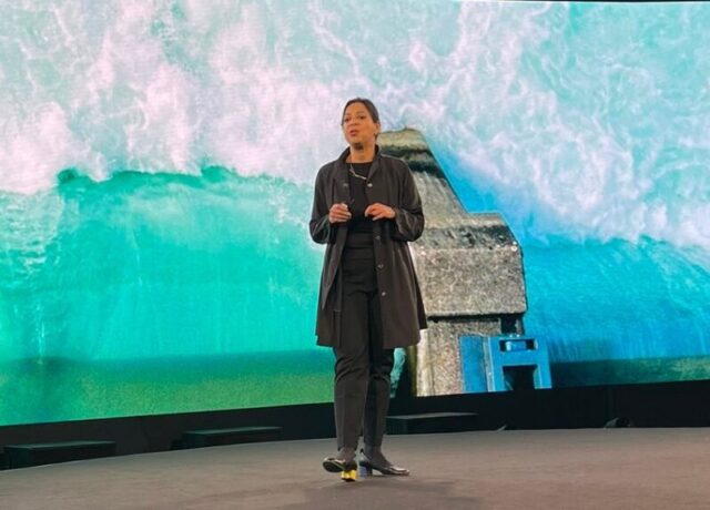
But taking the stage on day 2 of the conference was Deb Chachra, professor at Olin College of Engineering and author of “How Infrastructure Work, Inside the Systems that Shape Our World, graciously provided by Bentley Systems to media in attendance. Chachra looks at the bigger picture, going back to the earliest water systems, before “infrastructure” was a word, connecting infrastructure with energy. How one begets the other has given us systems that grow exponentially. They feed off each. All of them have big-time unintended consequences. Bad ones. It is leading to the despondency she sees in her students who think the previous generation has benefitted from the systems created (energy, transportation, infrastructure, etc.) and left them the mess to clean up.

Inside the Systems that Shape Our World

The following is a transcript, more or less, of Prof. Deb Chachra’s talk.

An engineering education pushes us to think about the bigger picture. It’s not just about infrastructure, but people, communities, their environment. It’s not just about the latest tools and systems; it’s about creating a better, more sustainable and inclusive world. That’s something we can always aspire to. I like to do big-picture thinking, so when I get into infrastructure, I’m mostly interested in how students work with knowledge.

I base my favorite definition of technology on a science fiction author. She pushes back against the idea that technology is just the latest cutting-edge stuff. She said that “technology is how humans focus physical reality, how we shape the material world.” I love that. That definition reminds us that technology is more than just what is the latest development. That definition is about our interaction with physical reality. Infrastructure fits in this definition.

I’m the daughter of immigrants to Canada. As a kid, I was really aware of how different life was for my parents and their families back home. We had to make sure that we had water and electricity all day. In the summertime, power could go out. It made me aware of how much daily life is made possible by the support of infrastructure. Here, I turn on the lights and turn on the tap, and I don’t even think about it. Those needs are met and those systems enable my life.

There are so many examples of this. Wherever you live, once you have infrastructure that meets your survival needs, the next thing that people focus on is their desires and aspirations. That connection is so certain that people studying economic development can use artificial light as a proxy for progress in a region. This connection is tied to agency and it’s super important. Amartya Sen, who studied some of the poorest communities in the world, wrote that poverty isn’t just a lack of income but a lack of freedom to lead the kinds of lives people value. That’s the sustained freedom that helps us achieve our potential.

Our agency, my agency, comes from being part of these collective systems. It’s more than what I can do on my own. When I think about water, sewage, energy quality—these are the things that really differentiate places. They’re about networks that bring people together. They’re intrinsically linked, not just to the people where they are but also to each other. I use a canonical example: living in New England, where infrastructure was built out in the mid-20th century. Everyone needs clean tap water every day. It makes sense to have a network that serves everyone. It’s more efficient, not less, to have a networked system.

Once you build out a system, it only requires a little energy to serve additional people. As an engineer, that made perfect sense—it’s a matter of energy and efficiency. Our systems are powered by collective effort. Energy is the actual currency of our material world. We use energy to get more energy. The first coal-powered engine in England used coal to pump water out of mines so that more coal could be mined. Looking at global energy usage over the centuries, you see how we’ve scaled up to serve more and more people through these systems.

Now, we live in a world of global networks. Take containerization, for example. It made global trade and the movement of goods much more efficient. A lot of the stuff you use every day has been transported across the planet. It’s part of a global civilization that allows us to maintain relationships and communities across distances—whether that’s with family, colleagues, or online communities. And now, communication networks are nearly everywhere, with people having access to them wherever there is power.

But we’ve also become embedded in systems that extract resources, mine them, move them and transform them. The Industrial Revolution supercharged extraction, turning raw materials into the components of modern life. Take copper, for example. It was considered a precious metal not because it’s rare but because of its unique properties. It’s necessary for electricity and for conducting power across vast networks. As we’ve gained access to more energy, we’ve made things more disposable, moving from a world where materials are precious to one where they are used freely.

These collective systems have allowed us to live in a world of abundance, but they have also placed harm elsewhere. The benefits are often enjoyed by people far from where the negative impacts are felt. Think about pollution or climate change—these problems affect people differently depending on where they are and often those contributing the least to the problem are the ones facing the most harm.

All of these networks have benefits and harms and their distribution is often unequal. The landscapes that our systems were built on assumed stability, but now we have to contend with the impacts of climate change. We have to adapt our systems to a new reality, to a world where we need to both mitigate and respond to environmental changes.

When you look at the Earth from space, you realize that it’s a closed system. Every atom that we mine has to go somewhere. That means every decision we make about resources has a cost, whether that’s mining or building infrastructure. We have to find ways to meet our needs without depleting our resources.

The reality of our planet is that it is finite, but we can adapt. We need a dramatic shift in how we think about energy and materials. The last big shift came when we used energy to extract resources on a large scale. Now, we face two global problems—energy and materials. The students I teach, the next generation, understand that they will be dealing with these issues for the rest of their lives.

We’re at a point where we need to align our thinking to build a world with renewable, scalable and resilient systems. It’s about creating opportunities and building systems that are both sustainable and equitable. There’s no path to this future that doesn’t involve transforming our infrastructure. That’s one of the powerful possibilities of this moment: the potential for everyone to access energy and resources.

It’s hard and we have yet to figure it all out, but we have the tools and the vision to get there. I talk about this a lot with my students—about embracing agency and the role of technology in shaping the future. We have to think about our values and make them explicit, not just assume them. It’s about thinking critically about our relationships, our responsibilities and how we engage with complexity in a world that’s more interconnected than ever.

The place I want to end is with the idea of building a world where everyone has access to energy, where systems are resilient and sustainable and where we all have the freedom to live meaningful lives.

That’s our goal and it’s within our reach.

0FansLike
0FollowersFollow
0SubscribersSubscribe
Google search engine

Recent Articles

Trending Now